
One patch of ground, nine names
Xi’an is one of the oldest continuously built-up places in China, and it carries one of its youngest names. Capitals stood on this stretch of the Wei River plain long before anyone called the place Xi’an. The name dates from 1369.
The names here rarely described the landscape. They recorded who controlled it. That is why there are so many of them, and why they do not sit on the same walls.
What “Xi’an” actually means
The Shaanxi provincial gazetteer office states the change plainly: in the second year of the Ming Hongwu reign, 1369, the prefecture of Fengyuan was renamed Xi’an fu. Xi means west; an means peace, or to settle. The name reads as a statement that the west was settled.
The same office explains the choice. The Ming founder kept his court at Yingtian, present-day Nanjing, and Xi’an lay west of that capital as a major stronghold on the western approaches, so the security of the west mattered. The English page published by the Xi’an municipal government renders the name slightly differently, as “to pacify northwest”. Both readings agree on the substance: this is a name about control, not a description of a place.
The names before 1369
The provincial gazetteer gives the immediate run-up. From the Tang through the Song and Jin the city was Jingzhao fu. In 1272 Kublai Khan enfeoffed his third son, Mangla, as Prince of Anxi, and the prefecture became Anxi lu, “pacifying the west”. In 1312 the court renamed it Fengyuan lu. Then came 1369.
Earlier names reach much further back. The Zhou kings built a pair of capitals on the Feng River, known together as Fenghao. The Qin state moved its capital to Xianyang on the north bank of the Wei. Liu Bang, founding the Han, placed his capital on the south bank under the name Chang’an, and the Sui built a new capital called Daxing before the Tang restored Chang’an again.
These are not successive versions of one address. Fenghao, Xianyang and the Han and Tang capitals stood in different places on the same plain, and the walled centre most visitors walk through does not stand on the full footprint of the Tang capital.
Why the old name was dropped
Chang’an means “long peace”, and a name like that is a claim as much as a label. The provincial gazetteer describes Xi’an’s naming as growing out of an older pairing: Xijing, the western capital, and Chang’an, two titles that had alternated for this same place.
The renaming fits a pattern in which each administration restated its own hold on the west — Anxi, then Fengyuan, then Xi’an. The name that survived is the one issued by the government of the day, not the one the city earned while it was a capital.
The rename and the wall belong to the same years
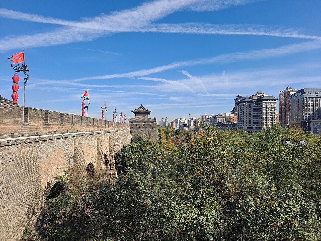
The provincial gazetteer dates the surviving wall to 1370–1378, the years immediately after the renaming. The Hongwu emperor put the Marquis of Changxing, Geng Bingwen, and the regional military commissioner Pu Ying in charge of the work.
The Ming engineers did not start from bare ground. The south and west walls follow the line of the Tang imperial city, while the north and east sides were pushed outward by about a quarter. The circuit measured 13,912 metres excluding the projecting bastions; there are 98 of those bastions, and the wall stands about 12 metres high.
The four gates carry names of the same temper as the city’s own: Changle, “lasting joy”, in the east; Anding, “settled”, in the west; Yongning, “perpetual peace”, in the south; Anyuan, “far peace”, in the north.
Which city are you actually visiting?
This is not only a historical curiosity. When an itinerary says Chang’an it usually means the Han or Tang capital, which stood elsewhere on the plain. The pagodas that survive from the Tang stand outside the Ming walled town, and the Terracotta Army and the Qin capital belong to an earlier world again.
The old name has not vanished either. Chang’an is the name of a district of the modern city, so a sign reading Chang’an today may point to a suburb rather than to an imperial capital. Match the name to the map before you set out.
Where the layers are visible
The wall is the clearest single answer. Almost everything you can still see inside the walled centre was built after 1369, and the gates and towers are products of the city the Ming reorganised.
For the earlier layers you have to leave the centre. The surviving pagodas south of the city belong to the Tang; the Terracotta Army belongs to the Qin. Standing on the wall and looking out is the quickest way to feel the distance between the names.
Opening hours, admission and access arrangements for the wall and for individual sites change with the season and with conservation work. Check the operator’s current notice for the day you plan to visit.